By using this website, you agree to our use of cookies (needed to provide our website’s features) and our Terms of Use.
By: Andrew Forrest - June 2024
Are you looking for the perfect companion for your Lake District adventure? Look no further. This article presents a curated collection of walking and adventure books that not only navigate you through the breathtaking landscapes of the Lake District but also delve into its rich history and culture.
Whether you prefer detailed walking guides with maps or inspirational narratives that capture the essence of the Lake District, our selection has something for everyone. Designed for leisurely walkers, dog walkers, families, and serious hikers, these books are more than just guides - they are your key to unforgettable experiences.
This page contains affiliate links. If you buy products or services via these links, we may earn a small commission at no cost to you. If you are thinking of buying, please use our links, as it helps support our website and YouTube channel.
The Lake District National Park in Cumbria, a haven for walkers, has been immortalised in classic walking guides that have stood the test of time. These guides not only introduce you to the landscape and paths but also to the rich history and soul of Cumbria. From leisurely strolls through low fells to challenging hikes, these guides offer expertly written, often numbered directions, ensuring ease of use and instilling confidence even in novice adventurers. So fasten up your boots, and with these books in hand, you can explore the Lake District with reassurance and confidence.

Looking down towards Keswick, Derwent Water, Catbells, with Helvellyn visible on the far horizon
The Lake District books below cover most of the best walks in the Lake District and are generally set out into distinct areas. They cover the majority of the highest Lake District fells and mountains, along with the lower fells, lakes, tarns, and basically everywhere that is picturesque!
I find that one of the main things to be mindful of when reading walking books and guides is the maps. Some are hand drawn, in the main so as not to incur a license fee from Ordnance Survey, and some are set out on maps, usually Ordnance Survey or Harvey maps. In case I need them to look at the wider area, or if I stray from the route, I always make sure I have the full Ordnance Survey map of the walks I am doing as well and a compass. I plot the route out on the map, which is why, even though they aren't a book I have included a section on Lake District maps below - four maps cover the whole of the Lake District.

Looking down towards Small Water and Haweswater Reservoir beyond from the Nan Bield Pass on the Kentmere Horseshoe walk
Many of the walking books below are now available in a variety of formats, catering to your reading preferences. Whether you prefer the traditional feel of a paperback, the durability of a hardback, the portability of an eBook, or the convenience of reading on your Kindle or other e-readers, we have you covered.

Looking back down the Newlands Valley from Dale Head on the Newlands Horseshoe in the Lake District
The timings in guidebooks are always estimates. I find that I generally get around quicker than those quoted, but if you are a slower walker and spend more time lingering to enjoy the beautiful views, then allow more time, especially if daylight is short. Some books include short sections on walking safety, but if you are new to walking, check out our Day hiking essentials checklist, our Beginners guide to hiking and our Top 15 safety tips for hiking.
One other tip for using walking books and guides is to check on the publisher's websites or as directed in the book for any updates. Whilst hills and mountains don't move, footpaths sometimes do and recommended places to eat and drink may close, so check for any updates.
There are many specific walking books for the Lake District covering high-level walks, low-level walks, lake walks, town and village walks, dog walks, short strolls, long hikes, accessible walks and walks for families, and we cover most of these below. Most people's first walking book of the Lake District is more of a general book that covers all of these, so you can pick and choose walks according to your level of fitness, time available and the walking you like to undertake. So, we have set out below our selection of a couple of general Lake District walking books to give you a great introduction to walking in the Lake District.

 |
 |

This Ordnance Survey walking guide for the Lake District, authored by Terry Marsh, covers 28 mostly circular walks ranging from 2.5 to 10 miles, from short strolls to long hikes. Each walk gives a summary table showing the start point, distance, height gained, approximate time taken for the walks, parking, the type of terrain you will be walking over and which Ordnance Survey maps cover the area the walks are in. There is a small OS map extract that shows the route of each walk, along with GPS waypoints for any points indicated on the maps.
There is also a helpful 'at-a-glance' page showing you all the walks in the books and the main information for each one. You can start with lower walks like Buttermere and Loweswater and on low fells like Loughrigg before moving on to explore Catbells and Little Mell Fell. For those wanting to try longer, higher walks, the book covers Bowfell, Skiddaw and Black Combe, amongst others. The walks are spread out all over the Lake District, so you can visit areas you are not as familiar with. Overall, it is a very good book for an introduction to walking in the Lake District. This book is part of the Pathfinder series of walking books.
|
|

If you enjoyed the first book, then Ordnance Survey and Terry Marsh have also produced a follow-up - More Lake District Outstanding Circular Walks. The book follows the same format as the first one, so for each of the 28 walks, which vary from short strolls to long hikes, you again get a summary table showing the start point, distance, height gained, approximate time taken for the walks, parking, the type of terrain you will be walking over and which Ordnance Survey maps cover the area the walks are in. There is also the small OS map extract that shows the route of each walk, along with GPS waypoints for any points indicated on the maps.
This time, you can start with the short strolls on the low fells, such as Aira Force, Dalegarth, Great Mell Fell, and Rannerdale Knotts, before moving on from the low fells and trying Castle Crag, Rydal Water, Grasmere, and Tarns Hows, to name but a few. The higher and longer walks in the book include Dow Crag and Goat's Water, Place Fell, and the Coledale Horseshoe.
I have included this book and the previous one rather than the two other Pathfinder guides they followed (Lake District Walks and More Lake District Walks), which cover many more of the popular walks in the Lake District. These two books are also good books, but as they are older, some of the path information could do with updating on some of the walks. They are still worth a read, though, and at often reduced prices, they are great value!
For those who yearn for the heights and exhilaration of the Lake District's grandest peaks, some guidebooks specialise in the thrill of fell walks and mountain days, and many cover all the highest peaks in the Lake District.

A selection of full-day walks in Lake District walking books
Below, I have listed a selection of books that I have read and used. These books offer some great Lake District walks over the higher Lake District fells and peaks, and many are half-day or full-day walks out on the hills.

|
|

Released in February 2024 is Vivienne Crow's book on walking the highest mountains in the Lake District.
A guidebook to 30 high-level day walks in the Lake District, exploring some of the finest mountains, ridge walks, fells, and summits within the Lake District National Park. Most routes are circular, with a few linear paths utilising public transport links. They vary from 7 to 24 km (4–15 miles) in length and can be completed in 3 to 9 hours. The walks are graded by difficulty, ensuring options for all fitness levels and experience. The walks are geographically grouped into six areas: Keswick, Borrowdale and Buttermere; the Western Valleys, Coniston and Langdale; Ambleside and Windermere; and Ullswater.
From classic horseshoes to well-trodden routes onto some of the quieter summits, this guidebook covers 30 of the best high-level fell walks in England's beautiful and much-loved Lake District National Park, including Scafell Pike, Helvellyn, Skiddaw, the Newlands Round, and the Fairfield Horseshoe.
For each walk, there is a 1:50,000 OS map and a GPX file available to download. The walks also provide detailed information on terrain, refreshments, and public transport, as well as information on local history and archaeology.

|
|
An inspirational guidebook to the best days out in the Lake District mountains, featuring iconic peaks such as Scafell Pike, Fairfield, Helvellyn, Skiddaw, Coniston Old Man, Haystacks, Wetherlam, Pillar and Blencathra, along with other lesser-known yet equally stunning mountain walks. Each route promises a Great Mountain Day in the Lakeland Fells, offering challenging walking that showcases the breathtaking beauty of the Lake District.
This expansive guidebook is perfect for selecting your next mountain to conquer, whether a renowned classic challenge or a beloved peak approached via a fresh route. It is ideal for newcomers to the Lake District fells and seasoned walking veterans who think they know the area inside out! Many walks from locations, including Ambleside, Keswick, Patterdale, Seatoller, Boot, Ennerdale, and Wasdale Head.
Each of the 50 great mountain days can be completed in a single day or serve as the foundation for backpacking adventures if you join them together. The circular routes range from 4 to 14 miles in length and are graded by difficulty, making this guidebook suitable for less experienced walkers and those seeking a challenging day out on the fells. The book offers clear route descriptions, HARVEY mapping, and the author's charming hand-drawn illustrations, enriching the journey.
The book was originally published in March 2008 but was reprinted with updates in May 2022. It has been a firm favourite on my bookshelf since then. Cicerone, the publisher, has an updates section on its website.
If you enjoy this Mark Richards book, he has included some of these walks in eight area-specific books that contain many more walks to do in each of those areas. Again, all are a great read and very informative for planning walks. Cicerone reasonably recently published them. They are very useful if you stay for a while in one area to explore all that area has to offer. The eight books in the Lake District fells that cover short strolls to long hikes are:

|
|
Including Blencathra, Bowscale Fell, High Pike, Latrigg, Skiddaw, Winlatter and the Northwestern Fells.

|
|
Including Great Gable, Kirk Fell, Pillar, Lingmell, Scafell, Scafell Pike and Yewbarrow

|
|
Including Bowfell, Crinkle Crags, Harrison Stickle, Loughrigg, Pike o'Blisko, Scafell Pike, Sergeant Man, Silver How and Central Fells

|
|
Including Black Combe, Buckbarrow, Hard Knott, Muncaster Fell, Swirl How and Coniston Old Man

|
|
Including Castle Crag, Catbells, Eagle Crag, Great Gable, High Spy, Maiden Moor, Scafell Pike and Ullscarf

|
|
Including Dale Head, Grasmoor, Grisedale Pike, Haystacks, Hindsgarth, Mellbreak, Red Pike and Robinson

|
|
Including Caudale Moor, Harter Fell, High Raise, High Street, Kidsty Pike, Wansfell and Thornthwaite Crag

|
|
Including Catstycam, Dove Crag, Fairfield, Helvellyn, Raise, St Sunday Crag and Watson's Dodd.
Walking in the Lake District is inclusive, with paths and trails designed to suit every age and ability. Books catering to short strolls and low fells are perfect for those who prefer a leisurely pace or introduce younger members to the joys of walking.

A selection of Lake District walking books, including shorter and lower walks
For families and those preferring short strolls, there is no shortage of routes that combine scenic beauty with historical significance. Some of my favourite, much-frequented walks are the Buttermere Circular, Grasmere, Rydal Water, and Tarn Hows, which often feature in many of the guidebooks on the Lake District and offer wonderful views of the Lake District fells and lakes.

|
|

This is a guidebook to short walks in the Lake District, with a great selection of walks for visitors to the Lake District and for more seasoned walkers wanting new routes to try. Whilst my legs still allow, I do like the high lake district fells, but if I'm walking on consecutive days, I do enjoy these very scenic short strolls on Cumbria's lower fells to give my legs a little less pounding on the second day, and this book includes quite a few of my favourites.
This Ordnance Survey pictorial guidebook, authored by Terry Marsh, includes twenty short walks in the Lake District. These walks are ideal for families and are chosen with accessibility in mind. You can enjoy gentle lakeside rambles or stretch your legs with more adventurous walks up to stunning viewpoints.
The walks range from two to six miles long and include OS Explorer 1:25 000 scale map extracts for every route. They also include information about what to expect along the way, including ascents, stiles and any difficult terrain. There is information about places of interest you pass on the way around, as well as pubs and refreshment places nearby.
An easy-to-use at-a-glance table summarises each walk in terms of highlights, what you will see, distance, estimated time, and places of refreshment.
The Lake District Short Walks book includes Tarn Hows, Castle Crag, Grizedale Forest, Rydal Water, Elterwater, Loughrigg, Latrigg and Cat Bells. For me, Cat Bells can provide youngsters with their first real taste of Lake District fells, with its beautiful views of Derwent Water and beyond. If you are feeling adventurous, you can carry on and do the whole Newlands round, but that is a much longer, more strenuous walk, included in the high-level Lake District walk books above.
The book was revised in 2016 and is an easy-to-follow guide to short strolls in the Lake District.

|
|

This is another Vivienne Crow book, this time covering low-level and lake walks. Whilst there are not any really short walks in the book, they are all reasonably low-level or around lakes. This guidebook describes some of the finest low-level walking in the Lake District, featuring routes around lakes, smaller fells, and other scenic spots. Some of my favourite lower-level walks included are Tarn Hows, Loughrigg Fell, Grasmere and Rydal Water, Ullswater Shore, and Aira Force.
If you want to see a couple of the walks in this book in much more detail, check out our full-length videos, which show the whole walk of Elterwater, the waterfalls, and the circuit of Buttermere.

Looking towards the Langdale Pikes over Elter Water

View through to Elter Water from the walled track

Buttermere lakeside path
Newcomers to the Lake District will be captivated by the variety of walks that showcase the Lake District National Park's most picturesque areas, including Windermere, Grasmere, and Ambleside, as well as quieter locales like Buttermere and Thirlmere. Even seasoned walkers may discover new, beautiful, low-level walks within these pages.
The walks vary from 7 to 17 km and cater to walkers of all skill levels. OS map extracts accompany each route, and they say they should pose no significant technical challenges. They range from wide, constructed trails to narrow paths on open fells, though some walking may include short stretches of boggy moorland.
The book is divided into five sections covering the whole of the Lake District: South Lakes (Windermere, Coniston, Duddon, and the south), Central Lakes (Ambleside, Langdale, Grasmere, and Thirlmere), Western Valleys (Eskdale, Wasdale, and the Buttermere area), North Lakes (Keswick, Borrowdale, and Derwentwater), and Eastern Lakes (Ullswater and Patterdale).
The book was first published in 2014 and was reprinted in 2022. In addition to the walks, it includes sections on geology, wildlife, getting around, maps, and dogs, amongst others.
For the visually inclined, a pictorial guide with stunning panoramic photographs offers a feast for the eyes and the soul. There are many pictorial guides to the Lake District, and as the landscape of the Lake District fells, rivers, waterfalls, and lakes very rarely change; what you see in these books is still the same today as when the photographs were taken.

|
|
In many books, you may see beautiful panoramic views of the Lake District, whether the Lake District Fells, the lakes and bodies of water, tarns, stone circles, or the many picturesque waterfalls. But how do you find them, and what is the best time of day/year to replicate nature's wonders in your eye-catching panoramic photographs?
This Photographer's Guide to the Lake District book sets out to address that and does it very admirably. This book is such a brilliant but simple idea and contains everything a photographer needs to know about some of the most photogenic parts of the Lake District. This book is split into eight sections covering The Langdales, Coniston and Hawkshead, Ambleside and Windermere, Grasmere and Rydal, Ullswater, Keswick and Borrowdale, Buttermere and Crummock Water and Wasdale, Eskdale and the Duddon Valley.
A summary table of the 56 views shows the location, difficulty of the walk, time from the car park and photographic interest. The book also includes, besides the photographs themselves, directions to each location, maps, where to park, the best times to photograph and sunset/sunrise times. It is not a criticism of the book, but with the advent of ever-improving technology and apps, there are many apps available now that can be used in conjunction with this book that can give daily sunrise/sunset times, direction of the sun at different times of the day in any places etc., many of which are free.
Overall, it is a well-written and thought-out book suitable for photographers (or anyone with a mobile!) who want to get directly to a location very early or late in the day without wasting time trying to find a place. It comes in a popular pocketable format, so it easily fits inside your camera bag or rucksack.

|
|
Photographing The Lake District is a stunning guidebook. If you are looking for something to buy someone for a present or a gift that enjoys walking and the Lake District, then this book would make an ideal present. The updated 2021 edition of this pictorial guide now contains 528 pages featuring over 800 stunning photographs of Cumbria and the Lake District.
The views themselves cover lakes, tarns, jetties, bridges, valleys, waterfalls, woodlands, villages, wildlife, classic views, cottages and farmhouses, grand panoramic viewpoints, Lake District fells, shows and events, historic houses, castles, and gardens.
The viewpoints have been split into six areas for you to explore: South East Lakes, Central Lakes, South West Lakes, North West Lakes, North Lakes, and North East Lakes. Over 100 locations are described, most of which involve short strolls or are roadside, including many wheelchair-accessible places. This second edition also describes nine scenic high mountain walks for the energetic.
There are OS map excerpts featuring the locations and some pubs, written directions, smartphone-usable what3words, and scannable lat-long QR codes that help make getting to a location straightforward. The book also covers the best times to visit and seasonal highlights, photographic tips, accessibility notes, travel information, and some places to stay, eat, and drink.
The only downside, if there are any, is that it is too big to be a pocket guide, so I would suggest just copying the pages you need while you are out. Although it will fit in larger camera bags or rucksacks, it is pricier than most other books. You do get a lot for your money, but at its price point (currently £27), it is the most expensive book on this list.
If you are like me, after a decent day walking on the Lake District fells, whether that be on the high mountains, the low fells or even on short strolls, there is nothing that can quite beat something to eat and drink at a pub afterwards, and the Lake District has many good pubs... cafés, restaurants and hotels are also available! We do on our videos finish off with where you can eat and drink after the walk, but there are a few Lake District walking books around that also incorporate them at the end or during a walk.
The only thing I would say about pub walk books is that, sadly, many pubs have closed down over the last few years. You should therefore check on the internet first to see whether your chosen pub is still open. I have a few pub walk books from between 1995 and 2010; unfortunately, many of the pubs are no longer there!
With that in mind, I bought a couple of the newer published pub walk books and reviewed a couple more. As I knew a few of the pubs mentioned had already closed, I decided not to include them.
So, if you want a pub walk, I would suggest choosing your walks and then just looking on an up-to-date OS map or on Google to find the nearest pubs. Quite a few of the general Lake District walking books on this list do pass pubs along the way or have them near the start/end of the walk. If your walk starts or ends in any of the main towns and villages in the Lake District, there is generally a decent selection of good pubs to choose from, and we will keep adding them at the end of our walking videos.
I walk with many people who bring along their dogs. Being used to stiles of any description, they could happily do any walk in this list of walking books, and many have done so. I also walk with a friend whose dog just stares at stiles as if they are a brick wall and has no inclination of ever wanting to go over them, so they can only do walks with gates and without stiles.
If your dog fits into the latter category, I would check out the section below on accessible routes in the Lake District, which has 50 walks and short strolls without stiles and one further book. In our walking videos, we show the whole walk so you can see in advance whether you think the walk is suitable for your dog. We also try to ascertain whether the places to eat at the end of the videos are dog-friendly.

The stick just appears out of reach on the trig point
So, if your dog can cope with whatever obstacles it finds in its way, then most of the walks in all the books in this article should be suitable for them. If your dog can only manage gates or you don't fancy lifting them over stiles, then the miles without stiles section of the Lake District National Park, linked in the accessibility section below, would suit them along with these two books below that between them cover the South and North of the Lake District.

|
|
This countryside dog walks book covers the South of the Lake District. It has been written for dog owners and includes many photos of what you will see along the way. There are 20 beautiful walks in the Southern Lake District, each with an introduction, a map, and directions.
The walks in the book cater to all levels of fitness and ability, from short walks along lakeshores to more challenging hill walks. They cover Coniston, Elterwater, Grasmere, Langdale, and Windermere.
Having no stiles on the routes ensures hassle-free walks for both dog and owner. My only criticism is that there could be more longer walks in the book, as most of the dogs I walk with love the long hikes, and I would personally also take an OS map of the area.

|
|
As with the Countryside Dog Walks - Lake District South book, this Countryside Dog Walks - Lake District North book has again been written for dog owners and includes many photos of what you will see along the way. There are 20 graded walks in the Northern Lake District, each with an introduction, a map and directions.
The walks in the book cater to all levels of fitness and ability—from short walks along lakeshores to more challenging hill walks. They cover Buttermere, Derwent Water, Ennerdale Water, Glenridding, Keswick, Loweswater, Thirlmere, and Whinlatter Forest.
Having no stiles on the routes ensures hassle-free walks for both dog and owner. Again, my only real criticism is that there could be more longer walks in the book, as most of the dogs I walk with love long hikes. Again, I would always take an OS map of the area as well.
Families venturing into the Lake District will find an array of walks perfect for children, offering opportunities to engage with nature at a pace suited to younger explorers. These walks and adventures not only introduce children to the joys of the outdoors but also ensure that the entire family can partake in the beauty of the Lake District, creating memories that will last a lifetime.
Whilst quite a few of the walking books in this article include shorter, low-level/accessible walks that would be suitable for families, children often want a little more adventure and fun than just walking, so these two books have walks to keep them interested and include other outdoor adventures available in the Lake District.

|
|

The Outdoor Adventures with Children guidebook offers forty family-friendly days in the Lake District. Activities include walking, scrambling, cycling, paddling, boating, and bothying.
Each activity has OS mapping and easy-to-follow route descriptions, and the adventures are graded so families can pick the activities that suit them best. The bases for the activities are in the Southern Lakes, including Ambleside, Coniston, Grasmere and Windermere, and in the north, Keswick, Cockermouth and Glenridding. They include activities on or around Derwent Water, Buttermere, Ullswater, Cathedral Cave, Castlerigg Stone Circle, Wray Castle, Catbells, Coniston Old Man, Scafell Pike and Grizedale Forest.
There are also a few useful information sections, such as did you know facts and bad weather alternatives, along with detailed information on public transport, amenities, and bike and boat hire. Overall, this is a great value book to get children interested in the great outdoors.

|
|
This Go Wild! in the Lake District guide includes ten family-friendly walks and adventures in the Lake District National Park. This interactive guide is clear and well-photographed, with written directions and maps for each adventure. Each walk includes a map and four themed interactive challenges.
The walks/adventures include Binsey Hill bagging - summit sunset; St Herbert's Island - paddle and picnic; Hallin Fell - boat and climb; Crummock Water - wild swim; Buttermere - lake walk (with tunnel), Black Sail Hut - bike and bunk, Cathedral Cave - caves scramble, Stanley Ghyll - steam train & waterfall, Windermere shore - boat and bike, and Grizedale Forest - mountain biking.
It is another great book for taking children on adventures, but while bigger isn't always better, with one-third as many pages and a quarter of the number of adventures as the Outdoor Adventures with Children book, the Outdoor Adventures with Children book probably provides better value if you were to buy only one of them.
Okay, so swimming isn't walking, but you do need to walk to the places where the swimming takes place. As many walkers and hikers enjoy adventure and swimming, we chose two informative and inspiring books. There is also a lot of talk in the wellness industry at the moment on cold water therapy and its many benefits for the body.

|
|
This Swimming Wild in the Lake District book by Suzanna Cruickshank lists the best wild swimming locations in the Lake District and provides valuable tips for both novice and seasoned wild swimmers. It includes sections on beginning wild swimming and maintaining personal safety and offers unbiased advice on essential gear and what you can do without.
Just after publication, the book got off to a great start by winning the Outdoor Book of the Year in the Great Outdoors Awards of 2020. It quickly followed that by winning the Bill Rollinson Prize for Landscapes and Traditions in the Lakeland Book Awards 2021.
The book delves into hidden wild swimming spots in popular tourist destinations like Windermere and Derwent Water and the serene and lesser-known waters of Bassenthwaite, Crummock Water, and Devoke Water. The focus is on savouring the breathtaking surroundings while swimming. As the book says... Imagine yourself gliding through clear, still water, surrounded by rugged fells, with only the sound of birdsong to accompany you.
The locations are depicted with lovely photography, and each one is accompanied by an overview map. The book provides all the practical information needed to plan your wild swimming adventure, including access to the lakes by car or public transport where possible. It offers comprehensive details about the best wild swimming spots on all the featured lakes, sets out others' experiences, and recommends the top pubs and cafés for that much-needed post-swim drink or meal.
The book is well written, humorous and includes lots of helpful information, so whether you're an experienced wild swimmer or just dipping your toes in for the first time, you'll find plenty to inspire your next adventure.

|
|
While Swimming Wild in the Lake District was my favourite wild swimming book, for other swims and adventures, mainly as it includes the Yorkshire Dales and the Lake District, you can check out this Wild Guide to the Lake District and Yorkshire Dales. With its captivating photography and engaging travel narratives, this book is a guide for families seeking off-the-beaten-path adventures or explorers planning their dream weekend getaway.
Imagine a summer spent swimming in mountain waterfalls, exploring lost ruins and caverns, and camping in ancient forests. In this explorer's compendium, you will discover the most exciting and lesser-known places to visit in the Lake District and Yorkshire Dales, with magical places to stay and where to find the local and artisan food straight from the farm or field.
The guide is divided by geographic area, with each section offering suggestions, opinions, safety information, and places to eat. In the book, the Lake District is divided into eleven regions. The items within the book are also colour-coded by topic (water, land and wildlife, food, sleep, and general). The adventures listed also include activities for children and those who might not be as energetic as they once were. It contains ideas for their 'perfect weekend' in each area.
While the book has a lot of information, I found a few downsides. My eyesight isn't what it once was, but I found some maps challenging to read, and the light grey text used in places was too light for me, so I would also suggest taking along an Ordnance Survey map of the area. The indexing in the book could also do with a little more thought as I found it difficult to follow. But all that said, it shows you many places you may not have explored and gives ideas for many new adventures.
Literature has the unique ability to transport us to places we've never been, and nowhere is this more evident than in books about the Lake District. Exploring this national park through the written word reveals hidden places, secrets, and stories that even the most picturesque lake walks may not immediately unveil.
Throughout history, the breath-taking scenery of the Lake District, with its fells, lakes, and waterfalls, has inspired countless writers and poets to express their admiration for the region's natural beauty eloquently. From Wordsworth and Keats through to Simon Armitage and Val McDermid, the Lakeland fells have inspired creativity for them all.

|
|
Whilst there are many books and poems by individual authors on the Lake District, this 'A String of Pearls' Book on the landscape and literature of the Lake District is a stunning union of photography and literature. It was shortlisted for the 2022 Lakeland Book of the Year Award and the Latitude Press Latitude Press award for Illustration and Presentation.
In this captivating illustrated anthology, the author Margaret Wilson has selected some of the best Lake District literary extracts, each of which photographer Helen Shaw has paired with a stunning local landscape. The awe-inspiring fells, cascading waterfalls, and serene still waters of the Lake District have sparked the imagination of writers for centuries. This book features 60 excerpts from those esteemed authors and poets.
Idyllic Lake District literature, prose, and poetry are matched perfectly with vivid photographs of the sources and places referred to, each enchanting the other. The book evokes memories, making it a great way to envisage the Lake District, past and present. It would make a wonderful gift for anyone.
Certain names you'd expect to feature who, over the years, have become synonymous with the Lake District and many other less well-known writers and poets. The excerpts from books include William Wordsworth, John Keats, Melvyn Bragg, Bill Bryson, Arthur Ransome, Simon Armitage, Samuel Taylor Coleridge, Chris Bonnington, Beatrix Potter, Charles Dickens, and Alfred Wainwright, amongst many others.
Overall, this is a wonderful introduction to some of the literary greats, and 'A String of Pearls' is certainly a book to treasure!
Before I recommend a book, I suggest looking at the Lake District National Park website for accessible walking routes for people with limited mobility. It has a section dedicated to walking 'Miles Without Stiles'. They have set out 50 detailed walks that take you along lake shores and rivers, through woods, past historic remains, and some summits on Lake District fells from which you can admire the fantastic Lake District views.
These walks have no stiles, so they are more suited to people with limited mobility, wheelchair users, prams, and the visually impaired. If your dog struggles with stiles, they will also be ideal for them. Very few of the walking books I've read and reviewed go into this level of detail or thought on accessible routes, which is why I am recommending the Miles Without Stiles walks on the Lake District National Park website before any walking books.
They have graded the 50 walks into four categories:
All the 50 walks include route details, a downloadable map, start, turning and end points and any facilities. Within the 50 walks is one
to Orrest Head, where it 'all started' for one Alfred Wainwright and a couple of my favourites for views - Tarn Hows and Scout Scar. As they
are all freely available on the website, they are great value!

|
|

With all that said about the Lake District National Park's website, if you want a book, then the best one I've come across was another Ordnance Survey Pathfinder book, this time by Mike Routledge. The Lake District and Cumbria Accessible Walks book covers 38 accessible walks, 25 of which fall within the Lake District National Park. The remainder are reasonably close by except for a few outliers near Hadrian's Wall and Kirkby Stephen.
As with other Pathfinder guides, the walks include a summary showing start/finish, getting there, parking, facilities, distance, approximate time taken to do the walk, type of terrain you'll encounter on the walks, points worth noting and which OS maps cover the walk area.
Some of the walks included are Talkin Tarn, Caldbeck Village, Loweswater, Buttermere, Friar's Crag and Derwent Water, Blea Tarn, and Elterwater to Skelwith Bridge. Don't forget to check out our video of the Elterwater circular walk, which includes this stretch from Elterwater to Skelwith Bridge.
The routes are graded, and each of the all-abilities routes is graded for wheelchairs into easy, moderate, and challenging.
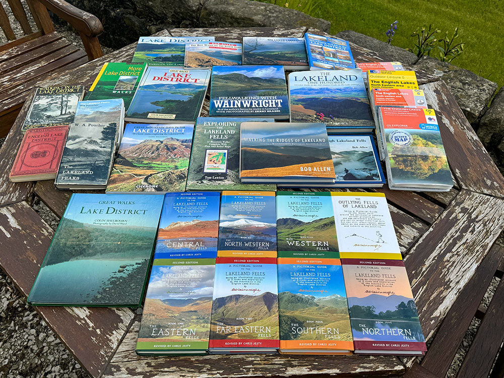
Having just mentioned Alfred Wainwright, a guide to Lake District books would be incomplete without him. The Lake District in Northwest England has long-enchanted walkers and nature enthusiasts. Among them, one individual stands out as a true ambassador of this stunning landscape: Alfred Wainwright. Wainwright, a celebrated fell walker, guidebook author, and illustrator, has left an enduring legacy in exploring the Lake District through his meticulously detailed books and maps.

Alfred Wainwright's Pictorial Guides to the Lakeland Fells
His primary legacy is the creation of the Wainwright's Pictorial Guides to the Lakeland Fells, a series of seven books that meticulously detail and describe 214 Lake District fells, now famously known as 'Wainwrights'. These guides highlight Wainwright's unwavering dedication to the region, characterised by his meticulous attention to detail and a uniquely distinctive artistic style.
Wainwright's passion for the Lake District fells was evident in his careful documentation of the fells, paths, and landscapes, making his works essential reading for both the novice and the experienced walker. His influence continues today as new generations of walkers turn to his guides for direction and discover the joy of exploring the Lake District through his eyes.
Our Alfred Wainwright's Lakeland Fells - the ultimate guide article takes you through the seven books on the Lakeland Fells (Eastern Fells, Far Eastern Fells, Central Fells, Southern Fells, North Western Fells, Western Fells and the Northern Fells) in more detail with an interactive map, with all books being updated for a third edition between 2015 and 2020. Whilst the books, as you can see from our detailed guide, are available individually, they are often available as a boxed set, which you could pick up at the time of writing for around £30, so less than £5 per book - great value if ever I saw it! This one is still in print and available on Amazon:

|
|
A key element elevating walking books from mere narrative to indispensable tools is the inclusion of maps, many of them Ordnance Survey (OS) Maps or Harvey Maps. Known for their detail and accuracy, these maps are essential for planning hiking routes and navigating the landscape with confidence.
OS maps, which are updated regularly and available in digital and paper formats, provide walkers with comprehensive information on footpaths, bridleways, and public rights of way. But you do need to know how to read and use them! The maps included in guidebooks are often small snippets from a larger map, so I always take the map from which the snippet came, which covers that area.
Whilst maps are not exactly books, I spend a lot of time studying mine to plan new walks and gain an appreciation of the area. Yes, there are Mapping Apps now for mobile or GPS devices, and whilst I do find them useful and use them, I still love looking at maps. I always take them on walks as well, as they can never run out of power!
There are other maps around, but I was brought up on Ordnance Survey maps. They have divided the Lake District into four areas: North East, North West, South East, and South West. Between these, they should cover your walks in the Lake District. Sometimes, when your walks cross from one map to another, you may have to take two maps.

The four Ordnance Survey Lake District maps
The scale of these Ordnance Survey Lake District maps is 1:25,000, so it shows enough detail for your walks and includes rights of way, footpaths, contours for the terrain, roads, railways, landmarks, historical sites, tourist information centres, car parks and local amenities, like pubs and campsites. The maps generally come as standard maps or weatherproof ones. For the extra few pounds, I would always choose the weatherproof map, which has served me well in rain, hail, and driving snow. Unfortunately, Lake District fells do get their fair share of rain! If you do use paper maps, I would suggest taking them in a waterproof mapping case.
The four maps you need to cover the Lake District and the Lakeland Fells are:

|
|
 |
|

This OS OL4 map of the Lake District covers the North-Western area of the Lake District and the North Western Fells, including Keswick and Cockermouth along with Derwent Water, Bassenthwaite Lake, Ennerdale Water, Crummock Water and Buttermere along with one of the most recognisable peaks - Skiddaw. This map has a free digital download, so you can access it across your devices, making it a convenient companion. The long-distance Cumbria Way footpath and the England Coast path also pass through this map area. The map covers a large area, so it is double-sided for ease of use.

|
|
|
|

This OS OL5 map of the Lake District covers the North-Eastern area of the Lake District and Lake District fells, including Penrith, Caldbeck and Patterdale along with Haweswater, Thirlmere and Ullswater, the second largest lake in the Lake District along with one of the most walked peaks - Helvellyn. This map comes with a free digital download, so you can access it across your devices, making it a convenient companion. The map covers a large area, so it is double-sided for ease of use.

|
|
|
|

This OS OL6 map of the Lake District covers the South-Western area of the Lake District and the Lake District fells, including Coniston, Ulverston, Ravenglass and Barrow-in-Furness. Besides many other peaks, this map includes Scafell Pike, England's highest mountain at 978 m in height. This map comes with a free digital download, so you can access it across your devices, making it a convenient companion. The long-distance Cumbria Way footpath and the England Coast path also pass through this map area. The map covers a large area, so it is double-sided for ease of use.

|
|
|
|

This OS OL7 map of the Lake District covers the South-Eastern area of the Lake District and the Lake District fells, including Windermere, Kendal, Ambleside, Grasmere & Silverdale. This map comes with a free digital download, so you can access it across your devices, making it a convenient companion. Besides exploring the Lake District's fells and valleys on the map, you could also try one of the longer distance paths running through it, which include the Cumbria Way, the Dales Way, the Lancashire Coastal Way and the Lune Valley Ramble. The map covers a large area, so it is double-sided for ease of use.

|
|
If you don't have any of these maps and want to invest in all four maps, I have found a four-map set that works out cheaper than buying the four maps individually.

|
|
Whilst I use the above four maps all the time I am walking or planning on walking in the Lakes, Ordnance Survey also makes custom-made maps based on the above maps, which I find ideal for gifts or presents for fellow walkers. You can get the same 1:25,000 mapping or choose a different scale. You can decide where your map is centred, personalise it with your own cover photo you upload, and choose your own title for the map. Besides paper maps, you can also buy these on canvas or framed, albeit neither of these two options is very practical for taking on your walk!
While I am covering maps, while not paper or a book, there are quite a few mapping apps that cover the Lake District, including Ordnance Survey, OutdoorActive, and Alltrails. Many of these have the same functionality, but as I grew up on Ordnance Survey maps, their app was the first one I tried and have used ever since.
Whilst there is a free version, for less than the price of a coffee/month, if you sign up for the annual subscription, you get unlimited use of all their Explorer (1:25,000 scale) and Landranger (1:50,000 scale) maps for the whole of Great Britain, so access to 607 maps that you can view on your phone or laptop/tablet or print them, so you have a copy with you in case your phone loses power. You can download map areas to your phone before you set off in case you lose signal whilst you are out on the hills, visualise the routes in 3D fly-throughs through the Lakeland fells and, access many other features and create and follow other people's routes.
Explore further and sign up for the OS Mapping App
The Lake District in Cumbria is not just England's largest national park; it's a mosaic of stunning landscapes, cultural heritage, boundless opportunities for exploration, and a place to enjoy British walking at its best. On July 10th, 2017, it was designated a UNESCO World Heritage Site, joining the Great Barrier Reef, the Great Wall of China, the Grand Canyon, Machu Picchu, and the Taj Mahal as one of the world's most significant sites.

Looking towards Skiddaw, Blencathra and Bassenthwaite Lake in the Lake District
The park's offerings extend beyond the Lakeland fells and lakes, including activities that cater to all interests, from boating on the lakes to climbing the high peaks. The rich cultural heritage of the Lake District is evident in its literature, art, and music, which have been inspired by its beauty and have, in turn, contributed to the region's identity. It is a place where every visit promises discoveries and where the natural environment continues to captivate and enchant visitors from across the globe.
Covering an area of 2,362 km², the Lake District is 36 miles wide at its widest and 40 miles tall, from north to south. It contains England's highest peak, Scafell Pike, along with many of the other of England's tallest mountains, including Scafell (964 m), Helvellyn (950 m), Skiddaw (931 m), Great End (910 m), Bowfell (902 m) and Great Gable at 899 m. Alfred Wainwright described 214 tops in the Lake District in great detail that many people set out to walk over time.

Looking back down towards Low Tarn on the climb up to Coniston Old Man in the Lake District
It also contains England's largest lake in Windermere and the deepest in Wastwater, along with many others, including Ullswater, Derwentwater, Bassenthwaite Lake, Coniston Water, Haweswater, Thirlmere and Ennerdale Water, to name but a few. One fun fact about the Lake District is that despite its name and numerous bodies of water, there is actually only one official lake in the Lake District, Bassenthwaite Lake, with all the rest being 'meres' or 'waters'. For sea lovers, the Lake District National Park also contains 26 miles of coastlines and estuaries.
Various geological processes shaped the Lake District's stunning landscape over millions of years. The region's bedrock, primarily composed of ancient volcanic and sedimentary rocks, dates back to the Ordovician period, around 420-450 million years ago. These rocks were formed through volcanic activity and the accumulation of sediments in ancient seas.

The Lakeland Fells from Arnside Knott
Over time, tectonic movements caused the land to buckle and fold, creating the mountains, Lakeland fells and valleys we see today. During the last Ice Age, glaciers carved out deep U-shaped valleys and sculpted the landscape further, leaving behind the dramatic scenery of rugged peaks and tranquil lakes. The retreating glaciers also deposited moraine, which dammed rivers and formed many lakes that give the region its name.
Nestled in the North-West of England, the Lake District's geographical positioning is as unique as the landscape it encompasses. The region is bordered by bustling cities like Manchester to the south and Carlisle to the north, with the West Coast mainline connecting it to London and Glasgow via Oxenholme station, just outside of Kendal. From there, trains run to Kendal, Staveley and Windermere. The Lake District National Park lies within the county of Cumbria, and Cumbria itself was formed in 1974 from the original counties of Cumberland and Westmorland.

Looking back down towards Windermere from a snow-capped Fairfield Horseshoe in the Lake District
The Lake District is dotted with towns and villages that are as diverse as the landscapes they inhabit. Some of the more notable ones include:
These towns and villages provide a unique and charming experience for visitors to the Lake District and are the start of many a good walk!
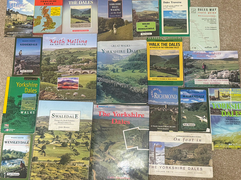
If you enjoyed our list of Lake District walking books, why not check out our list of Yorkshire Dales walking books?
Happy reading... and walking...
The Lake District's diverse landscapes, cultural heritage, and wide range of walking paths and tracks suitable for all ages and abilities, combined with picturesque fells, serene lakes, and rich literary history, make it a unique and captivating walking destination. In short, British walking at its finest.
Yes, plenty of walks in the Lake District are ideal for children and dogs. Many of the above books include walks and short strolls suitable for children and dogs. Enjoy exploring with your family and pets!
Yes, there are 'Miles Without Stiles' routes in the Lake District that are accessible for those with little mobility, allowing everyone to enjoy the region's natural beauty. Further details and links to them are above.
Alfred Wainwright was an influential author and illustrator known for his very detailed walking guides of the Lake District, which have contributed significantly to shaping the walking experience in the region.
Ordnance Survey maps are vital for Lake District walks as they provide detailed terrain, landmarks, and public pathways, ensuring safety and enhancing enjoyment for walkers... assuming you know how to use them!
June 2024